Day 30 Palmer Station & Gerlache
Strait
Antarctic Peninsula
Snow and sleet was coming down as we
approached the Palmer Archipelago of the Antarctic Peninsula. This
eased a bit as we pulled up outside Palmer Station on Anverse Island
to receive a Zodiac load of young scientists, students and staff from
the US scientific outpost. They would provide us with a lecture, Q&A
sessions and commentary as we explore the bays and sounds in the
area.
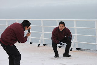
Out on deck the snow was accumulating,
much to the delight of our crew, many of who are from Indonesia and
have never seen snow. Watching them cavort and laugh was fun for us
as well. They treat us so well that it is a reward for us to see them
having such a fun time.
We planned to visit the Lemaire channel
but it was blocked with ice so we headed off for Paradise Bay,
circled Bryde Island, passed Browns Station, passed Gonzales Station.
The afternoon was a flurry of physical activity for many of the
passengers. While a few were content to sit and play cards, snooze
in the library or take a chair in the Crow's Nest or the buffet
dining room, many chose to chase scenery. With our onboard guests
from the Palmer Station calling the moves like square dance callers,
the active ones dashed from one side of the ship to the other, from
bow to stern, and up and down companionways to catch glimpses of
whales, sea lions, penguins, ice bergs, mountains, outposts, birds
and other interesting items and to photograph each event. This wore
me out to the point I could hardly raise my binoculars by late
afternoon.
 |
| Penguins on islet |
 |
| Browns Station |
 |
| A couple of humpback whales |
 |
| Penguins riding an ice chunk |
 |
| another humpback |
 |
| Ice outside Palmer Station |
Word came that the Lemaire Channel had
opened so off we went to see that. By the time we got deep into that
the ice had closed again so we turned around and headed back North to
the Bismark Strait and returned to Palmer Station. There was floating
ice and pack ice off the station but we went in and the zodiac came
out to bring departing students/scientists/staff and receive some
supplies and the guide team that had come aboard earlier. (I think
the guide team left the ship a few pounds heavier after we provided
them with all they could eat.) The farthest South we got was 65°
01'S.
After dropping off the research team
and picking up the departing research team, we worked our way out of
the pack ice with lots of complaining from the ice. The bridge
announced (we haven't heard from the Captain today) that we were
going to add a channel to our route and go up the Neumayer Channel on
the East side of Anvers Island. As it was starting dusk and we came
to the narrowest part of the channel we dropped speed and stopped.
Slowly the ship turned with the bow swinging past the ice cliffs.
After 90 degrees we backed further into the channel then continued to
swing the bow back to the way we came. At this point I noticed two
other passenger vessels (MV Fram and MV Spirit of the Seas, I
believe) also stopped at the narrows. As we retreated down the
channel the Fram and Spirit followed. With the wind coming right down
the channel at 34 knots, the channel must have become blocked with
ice. We continued back down to the Bismark Strait and Lemaire Chanel
where we were earlier (3 times) then turned East to retrace our
earlier route up Gerlache Strait, a wider strait on the other side of
the island from the blocked channel. By 2230 we were heading NE again
still surrounded by ice, rocks, floating ice chunks (“Bergy Bits”)
and what else went unseen in the snow and fog.
 |
| map from Antarctica Log Book -the ultimate journey |
More information at www.usap.gov


No comments:
Post a Comment